

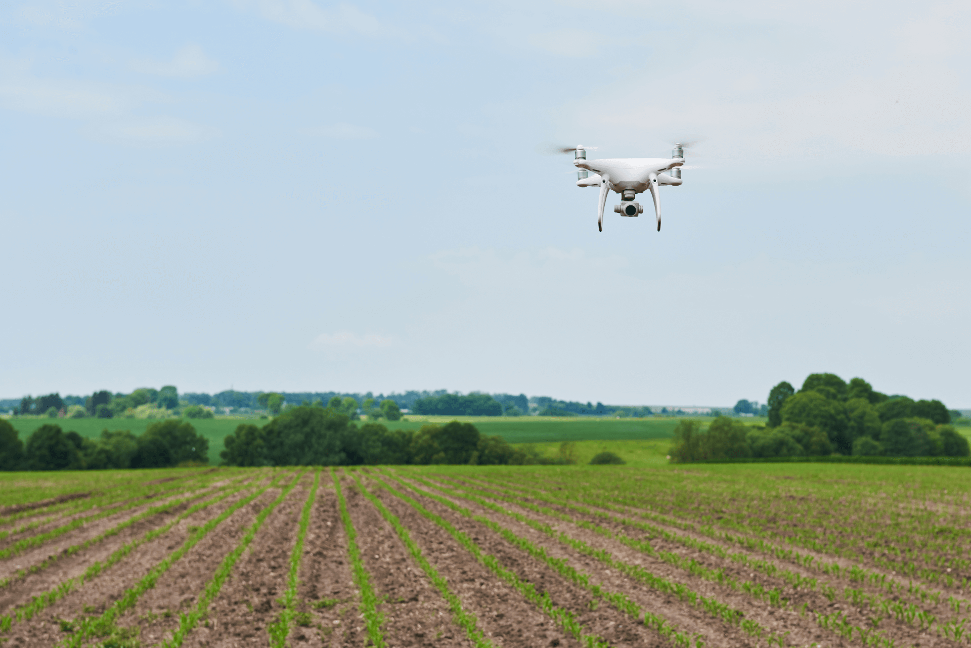
Across the agriculture industry there are multiple applications for drone technology. In this article we’ll review some of the more prevalent use of drones across the ag spectrum.
In agriculture, growers, ranchers, and farmers alike must cut costs while maximizing the land’s economic production. Weather and land movement could potentially present challenges – especially when expanded across thousands of acres of land. Drones can assist with insight across different ecologies, obstacles, and agricultural assets.
Leveraging drone technology can yield better results and more data across the agricultural spectrum. This article will provide a glimpse on how agriculture with drones can transform the industries.
Short Summary
- Drones can help growers apply Precision Agriculture techniques for better crop yields and livestock management.
- Drones are able to record and capture photography, satellite imagery, and video data – covering large land areas to quickly pinpoint where actions are needed.
- Agriculture drones are able to deliver real-time feedback on soil, plant, moisture, and topography to maximize yield, avoid waste, and increase the bottom line.
- Drones can be leveraged for livestock monitoring, farm security, condition monitoring, beneficial bugs (source), cross pollination, mapping, seeding, and spraying.
The Role of Drones in Agriculture
Drone Farming refers to the use of aerial drones to enhance various agricultural practices including crop health assessment, irrigation, crop monitoring, crop spraying, planting, and soil and field analysis.
The benefits of drone farming include less labor effort, higher productivity and more efficient use of resources including water, chemicals, fertilizers and land. Some of the most significant applications of drones in agriculture are crop spraying, crop monitoring, soil and field analysis, seeding/planting, irrigation, and livestock monitoring.
In South Korea, 30% of all agriculture spraying is done by drones, and in Japan, 40% of spraying in rice crops is done using drones. Transforma Insights estimates that drones use 30-40% less chemicals or fertilizers in the spraying process and are 40-60% faster than manual spraying. Furthermore, according to Bayer, drone water spraying uses 8-9 liters of water to irrigate one acre of land, while conventional spray pumps consume 150-200 liters. Drones can also reduce planting cost by up to 85% and help achieve rates of uptake of nutrients of 75% in addition to reducing the strenuous work of ground planting. – from Transforma Insights – article here.
By optimizing seed placement and mapping, drones can increase crop yield, and the American Farm Bureau Federation estimates that farmers in the US can save around USD1.3 billion every year by using drones in their operations. It is also estimated that in India drone-led farming can reduce input costs by 18-20% while enhancing yield by 30-100%. (source).
Drones are often referred to as a critical component in precision farming systems. Precision agriculture is defined as a farming management concept based on observing, measuring and responding to inter- and intra-field variability in crops. PA is also sometimes referred to as precision farming, satellite agriculture, as-needed farming and site-specific crop management (SSCM).
Farm Management
Farmers across the globe are considering implementing drone operations due to their many use cases across the farm environment. Aerial imagery can help farmers stay up to date in their land management approach. Video and photos via drone can be a cost effective and safe way to capture updated images of land and crops leading to more insightful decisions frequently cutting costs and increasing productivity.
With agriculture drone services, growers can:
- Additional insight when monitoring crop growth
- Increase crop growth by monitoring multiple issues affecting plant health and growth.
- Quickly find and address crop disease, infestation, or poor irrigation not seen in ground-level checks. Analysis tools such as normalized differential vegetation indexing (NDVI) help you zero in, compare, and adjust conditions to maximize yield.
- Leverage topographical, thermal, and spectral mapping to monitor and assess crop health faster with more precision over large land areas.
- Perform soil & field analysis to assess moisture and fertility levels, identifying irrigation and nitrogen management actions needed to reduce waste.
- Plant more efficiently by gathering visual data that maps the terrain and collects information about the topography and soil.
- Manage irrigation with a comprehensive and accurate lay of the land. Aerial photography makes it easy to identify slopes and drainage, and drones with thermal cameras can detect both dry and wet ground, allowing farmers to adjust irrigation as needed.
Drone Spraying
Drones can be an attractive, cost-effective alternative to traditional means of pesticide & crop treatment. deal with insects by using drones for spraying pesticides. Here is a an example out of India of how drones were leveraged acors Punjab and Haryana to spray crops (source).
Monitoring the Soil Health and Plant Health
Plant stress can be caused by multiple factors such as lack of water or unbalanced nitrate levels. Custom reporting makes it easy to translate the information capture by drones and take action based on the data. Insert software suggestion here?
Monitoring Field Conditions
When conditions are wet and muddy, no one wants to take the giant sprayer or tractor out to potentially get stuck in the mud, destroying crops that don’t need to be destroyed. Drones are a cheap and efficient way for you to monitor your field conditions and gauge the condition of the land avoiding hazardous or costly errors.
Improve Health and Safety
Many countries and/or developing nations can leverage drone technology within agriculture to increase crop production, limit human exposure to pesticides, eliminate need for manned aerial systems.
Livestock Management
Data collected via drone can help maximize the land’s resources and the livestock producer’s efficiency. Livestock managers and ranchers turn to drones for additional insight in data leading to a robust herd, additional cost savings, and smarter decisions.
Ranchers, herders, and producers alike often leverage aerial imagery captured via drone to execute precision ranching strategies. Precision ranching (PR) is defined as is the use of smart sensors for automated monitoring of livestock and other important components of ranching such as stock tanks and drinkers, rainfall, and forage growth. Precision systems are fairly common in intensive animal agriculture but their use in extensive ranching operations is still in its infancy (source).
With aerial drone photography, producers can:
- Take a comprehensive inventory of resources, locating the best areas for drinking water and creating a superior grazing management plan.
- Monitor fencing and pen conditions, saving time and the fuel required to monitor by ATV or automobile.
- Check for damage after severe weather, saving time and protecting ranch hands from precarious situations. Drone technology and imagery can potentially assist with insurance claims.
- Perform periodic inspections for counting or locating missing livestock and related tasks. Use infrared imaging day or night to quickly locate animals.
Forest and Land Stewardship
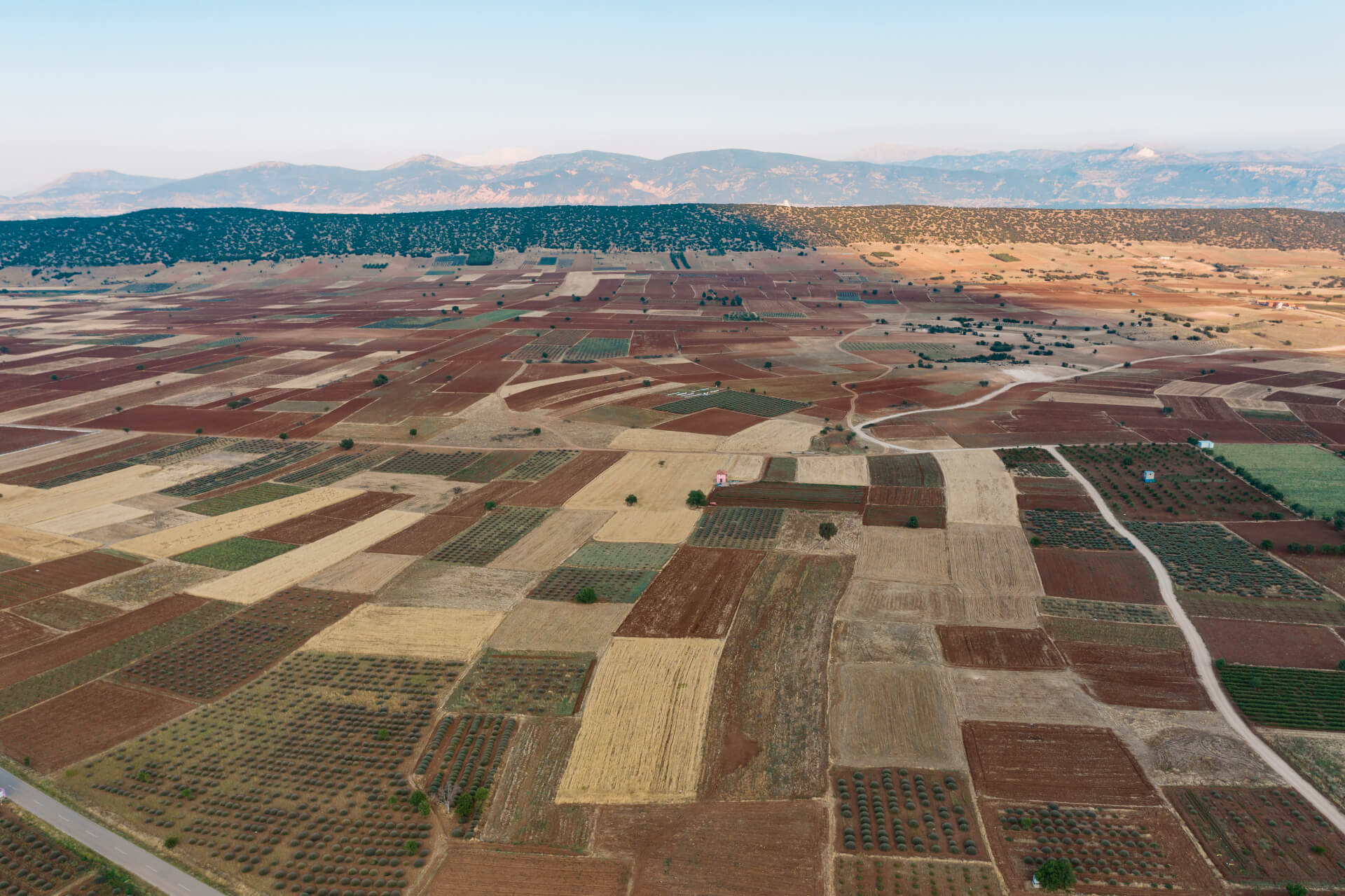
Typically – satellite data/imagery is not enough or outdated. Public and private entities in charge of large land masses can utilized aerial imagery captured via drone to develop land management strategies and plans along with monitoring the overall status and health of the acreage.
With aerial drone photography, land stewards can:
- Formulate an effective land management plan that considers boundaries, forest stands, wood species, biodiversity, and more.
- Create fully comprehensive maps of parcels, ensuring every acre is included in the land management plan.
- Predict and mitigate disasters such as forest fires, landslides, and ecological disease by gathering visual data otherwise unobtainable by ground-level or naked-eye assessments.
- Gather marketing photos and video for land to be sold.
- Conduct due diligence for aid program applications such as the Forest Stewardship Program, the Landowner Assistance Program, or USDA assistance programs.
Five Options for Agricultural Drones
Here are some of the most popular drones that are leveraged across the agricultural industry to apply some of the above – we’ll have an article dedicated to agriculture drone rankings shortly.
DJI – https://ag.dji.com/
Hylio – https://www.hyl.io/
Autel – https://www.autelrobotics.com/
Teladyne Flir – https://www.flir.com/products/siras/?vertical=suas&segment=oem
Parrot – https://www.parrot.com/us/drones
Putting it All Together
Across the agriculture space private and public entities are considering standing up drone operations. Farmers are able to leverage drones themselves or call on trained professionals to capture much needed data.
The agricultural industry across the globe is simply beginning its drone journey. As research continues and farmers and engineers find new ways to incorporate aerial drones into farming operations, we are likely to see considerable advances in agriculture sectors.
In our opinion it will soon be difficult to imagine successful agriculture operation without drones.